The Lofoten Archipelago
Travel photography for online hiking guide platform
Client: Left Foot Right Foot
The Lofoten archipelago lies in Norway’s far northern county of Nordland, far enough inside the Arctic Circle to experience "proper" winter conditions. The name “Lófót” supposedly stems from old Norse for Lynx’s foot, a clear nod to the shape of the islands which jut out from the mainland.
Visitors have been flocking to Lofoten, charmed no doubt by the endless barrage of Instagram posts of people standing atop granite cliffs rising 800m+ straight from the Norwegian Sea below, with over a million expected this year alone. The locals have had their fill with campers setting up in graveyards and next to town water supplies, in search of what little flat ground is available beside the only main road. Norway’s allemannsrett - "everyman’s right" - which allows free camping on public land is a big drawcard but is best used away from towns. When we visited, the biggest elephant in the room was the heated debate surrounding potential oil drilling in the archipelago, a hot topic in Norway’s recent election.
We headed north in July, Lofoten’s warmest and lightest month, to attempt a three-day walk along Lofoten’s northern coast, from Fredvang to Reine. Access to the islands is either from a ferry from Bodø, or a flight into one of Lofoten’s three airports, Leknes, Svolvær or Harstad/Narvik and while it is possible to get around just hitching or with the infrequent buses, a car (even for part of your trip) is a big advantage. We flew into Harstad/Narvik from Oslo and camped in Svolvær, Heningsvær and Utakleiv Beach, before getting to the most frequented southerly part of the islands.
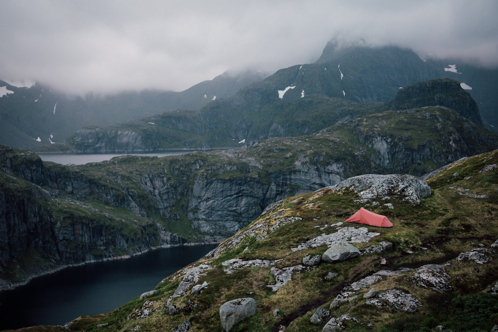
Despite being summer, we were pre-soaked with 2-days straight of rain before setting out from the Fredvang bridge into what we thought was a clearing mist, only to descend onto the first night's camp spot at Kvalvika to cloud down to 200m. In search of a rumoured hut on Vestervika beach, we pushed on around a sketchy cliff between the two beaches, with chains and old washed up fisherman’s ropes to guide us along. Upon reaching the hut, we found it locked (despite rumours suggesting it was open…) and had to huddle under a house-sized granite boulder to dry off. Despite the weather, the scenery was stunning, with the occasional glance up at Ryten, a 542m peak, between the clouds.
We called time on the hike after walking back out to the next road section in freezing conditions, completely soaked through our “waterproofs”, only to turn for the nearest campground at Moskenes (some 35kms away by road) when a cheery local picked us up. Followed by an even cheerier Norwegian, who opted to change his plans to take us the whole 35kms to the only campground with a laundry and dryer. The forecast looked good for two days time and we decide to make a reverse trip on our planned hike, going into Horseid Beach from Reine, making the most of the 24-hour sunlight.
A short but spectacular ferry ride on Kirkefjord from Reine, followed by a steep climb over a saddle dropped us into Horseid Beach, a beautiful white sand beach with crystal clear water and grassy camping spots on a headland. From here we watched the midnight sun do its thing (the sun touches the horizon, without setting, and then begins to rise again) and explored the many nooks on the north facing cliffs.
Although, not the full three-day trip, we managed to hike the bookends amid some foul weather, which more than made our trip worthwhile. We followed this up with an overnighter from Moskenes to Munkebu; a 12km round trip to a mountain hut with cliff top camping, wild alpine winds, but spectacular views. We then finished our round trip, heading by ferry to Bodø and flying on to Oslo.
The islands and their formidable weather are not to be taken lightly but with planning and some luck, it's possible to put together stunning multi-day or even just day hikes all over the islands and hardly see a soul. "Allemannsrett" and sticking to the few supermarkets can also make Norway, and the Lofoten islands an affordable trip!
The Norwegian Trekking Association has a great free map app for planning - https://goo.gl/7J59ZQ
Text by Keith Parsons and Gunvor Eline Eng Jakobsen